

Crinkle Crags - Long Top [Second Crinkle]
Good walks are even better shared.
NY2404 : The Bad Step
Ian Greig Photo source
Overview
Long Top, or Second Crinkle, is the 859 m highest point of Crinkle Crags in the Lake District. Its rocky ridge rises above Oxendale at the head of Great Langdale, south of Bowfell. The northern summit cairn is higher than the southern one. The established Bad Step bypass avoids that scramble, but the ridge still has steep drops and difficult navigation in poor visibility.
Crinkle Crags – Long Top [Second Crinkle]
Summit and setting
Long Top is the 859 m summit of Crinkle Crags, above Oxendale at the head of Great Langdale. Bowfell lies beyond Three Tarns to the north. The precise DoBIH summit grid is NY 24866 04872: the northern cairn is higher than the southern cairn. First Crinkle, the 834 m South Top, is a different summit. Third, Fourth and Fifth Crinkle and the Shelter Crags tops also have distinct records; Gunson Knott appears in more than one source name.
Walking routes
The two described circuits both return to Old Dungeon Ghyll. The Crinkle-only round climbs through Oxendale towards Red Tarn, traverses the ridge northward and returns over The Band. Walking Britain gives 11.4 km, 864 m ascent and 6 hours. The Bowfell combination climbs The Band first, continues south along Crinkle Crags and returns through Oxendale; UKHillwalking gives 12 km, 1,086 m ascent and 5.5 hours walking. These figures belong to separate complete routes and are not interchangeable.
Terrain and safety
This is rough mountain ground with steep drops and route-finding difficulties in mist. The Bad Step on Second Crinkle is optional: its established bypass is on the western flank, left when approaching northward from First Crinkle and right when descending southward from Long Top. The bypass does not remove the ridge's other hazards. Bad Step itself is steep and polished; UKHillwalking describes its downclimb as about grade 2. Wet rock, ice, strong winds and poor visibility increase difficulty. Do not improvise a gully descent or treat a specialist gill scramble as a walking escape.
Geology
Borrowdale volcanic rocks here preserve part of the Scafell caldera's eruptive and collapse history. Bad Step Tuff is a strongly welded rhyolitic ignimbrite, not simply a slate formation. Uplift and glacial dissection have exposed the internal geological structure. The Ray Crag and Crinkle Crags geological conservation account explains its scientific importance.
Name and history
The name describes the crinkled succession of rocky tops and hollows. A precise historical language derivation has not been established in this review. The wider Langdale valley has a history of climbing and farming. George Macaulay Trevelyan bought farms including Old Dungeon Ghyll and Stool End and donated them to the National Trust; this is valley context, not a claim about the hill's first ascent.
Access and facilities
National Trust visitor information identifies the Old Dungeon Ghyll pay-and-display car park at NY286061, with parking free for members. The Trust lists food and drink at the hotel's Hikers' Bar and the 516 bus from Ambleside to the Old Dungeon Ghyll Hotel stop. Check current parking signs and bus timetables, including the return journey. Parking space, opening hours and toilets have not been confirmed by this review. Use signed paths through farms, respect livestock and keep dogs under control.
Review scope
Sources checked 17 October 2026. Source publication dates and the imported DoBIH revision of 4 December 2016 are separate from this editorial review. Wrynose/Cold Pike/Pike of Blisco and Eskdale variants are not supplied with unverified distances or times. These summaries support planning and do not replace a map, weather check or mountain-navigation skills.
Explore routes near Crinkle Crags - Long Top [Second Crinkle]
Walks starting near this hill. Open a route to check its map, distance and full itinerary.
Great Carrs Halifax Wreckage from Wrynose Pass
View route
Bow Fell from Langdale
View route
Scafell Pike via Brown Tongue and Hollow Stones
View route
Scafell Pike from Seathwaite via the Corridor Route
View route
Route planning notes
These notes describe possible approaches. Check a route's map and access information when planning your walk.
Crinkle Crags ridge circuit from Old Dungeon Ghyll
Start and finish at Old Dungeon Ghyll car park (Walking Britain: NY286060). Follow the lane through Stool End Farm, then the signed path into Oxendale. Cross the footbridge and climb the pitched path towards Red Tarn. Turn west, cross the head of Browney Gill and pass Great Knott to First Crinkle. On the approach to Second Crinkle, take the established western Bad Step bypass, left when heading north. Reach Long Top: its northern cairn is higher than the southern cairn. Continue over the rocky ridge and Shelter Crags to Three Tarns, then turn right down The Band to Stool End and the original car park. Walking Britain gives 11.4 km, 864 m ascent and 6 hours for this complete circuit. The ridge is rugged and confusing in mist; bypassing Bad Step does not remove steep drops or navigation hazards. Do not descend an unverified gully.
Bowfell and Crinkle Crags circuit from Old Dungeon Ghyll
Start and finish at the National Trust car park beside Old Dungeon Ghyll; UKHillwalking gives NY285061 in its summary and NY2861406070 at the first waypoint. Go through Stool End and ascend The Band, taking the right-hand ridge path to Bowfell. Return east-southeast around Bowfell Links and descend the steep, rubbly path to Three Tarns. Follow the Crinkle ridge south to Long Top, visiting the higher northern cairn. For the non-scrambling Bad Step alternative, take the established western path, right when descending south; it rejoins at the col before First Crinkle. Continue over First Crinkle and southeast towards Red Tarn. Descend the pitched path beside Browney Gill, cross Oxendale Beck and return through Stool End to the same car park. UKHillwalking gives 12 km, 1,086 m ascent and 5.5 hours walking for this two-fell circuit. Mist, loose terrain and steep drops require care; Bad Step itself is a steep, polished scramble.
Make a day of it, together
Find someone to share the walk with, or organise a day out along a route you like.
Photo Gallery
View all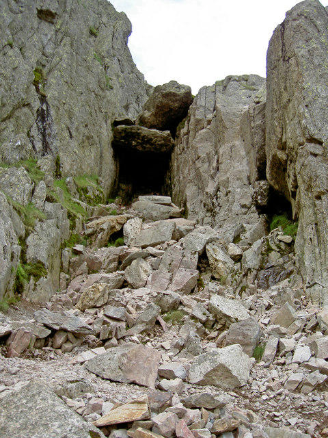 Photo could not load
NY2404 : The Bad Step
Ian Greig
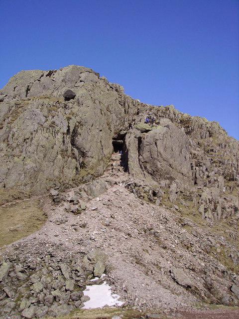 Photo could not load
NY2404 : The Bad Step
Michael Graham
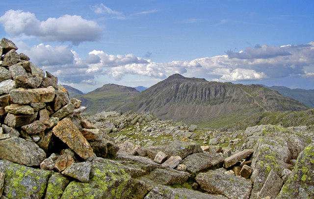 Photo could not load
NY2404 : Long Top summit cairn and Bowfell Links
Ian Greig
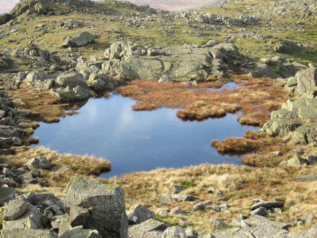 Photo could not load
NY2404 : Tarn on Long Top
Graham Robson
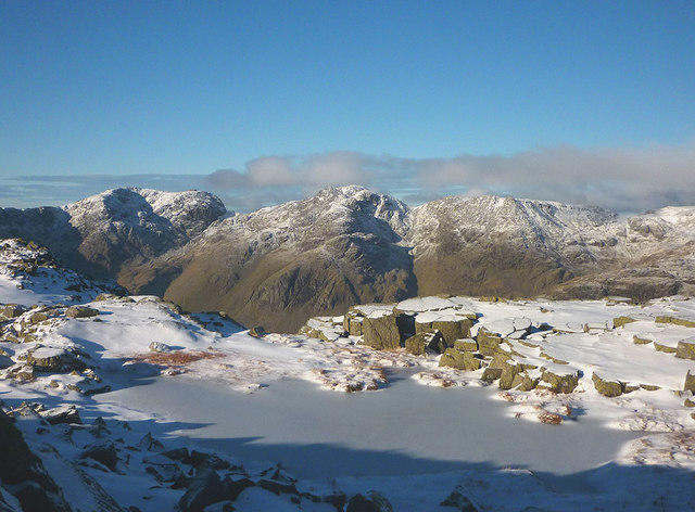 Photo could not load
NY2404 : Frozen tarn, Long Top
Karl and Ali
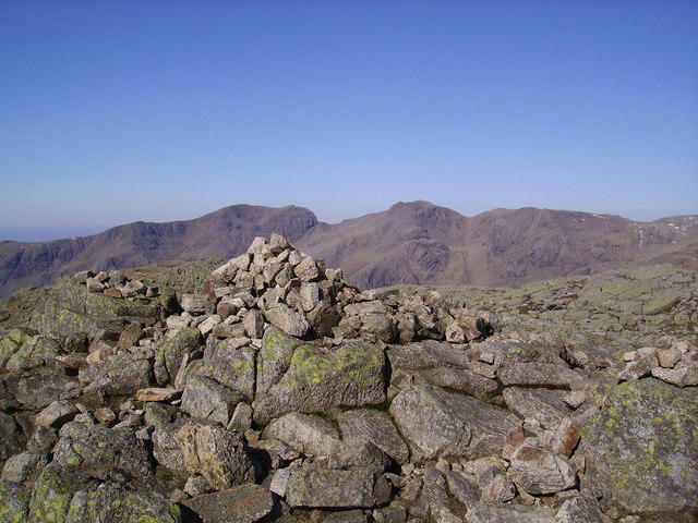 Photo could not load
NY2404 : Summit Cairn, Crinkle Crags
Michael Graham
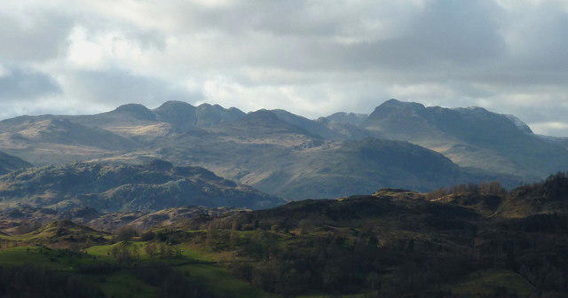 Photo could not load
NY2404 : Crinkle Crags and Bow Fell from Latterbarrow
Karl and Ali
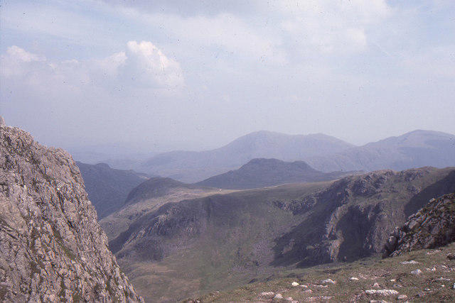 Photo could not load
NY2404 : Summit of Crinkle Crags: view towards Coniston Fells
Christopher Hilton
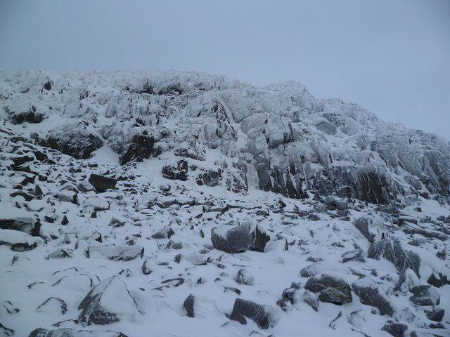 Photo could not load
NY2404 : Long Top
Michael Graham
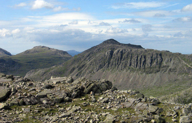
NY2404 : Rocks at summit of Long Top
Trevor Littlewood
Hill facts and local notes
Classifications
Elevation
859m
2,818 ft
Prominence
139m
Coordinates
54.4337, -3.1598
NY248048
OS Map
89 90
Explorer: OL6N
At the Summit
Long Top (Second Crinkle) is the 859 m true summit at NY 24866 04872. DoBIH records a cairn and specifies that the northern cairn is higher than the southern cairn. The separate First Crinkle/South Top is 834 m at NY250045; it is not the summit of Long Top.
Terrain & Geology
Crinkle Crags exposes Borrowdale Volcanic Group rocks associated with the Scafell caldera. BGS identifies the Bad Step Tuff near the summit as a strongly welded rhyolitic ignimbrite. The wider succession records explosive eruptions and caldera collapse; later uplift and glacial dissection exposed its internal structure. The specialist accounts support volcanic tuffs and ignimbrites rather than a generic claim about summit slate formations.
Views & Scenery
Views across Great Langdale and towards Bowfell, the Scafell massif and surrounding Lake District fells, when visibility allows.
History & Heritage
Name Origin
The name describes the ridge's crinkled outline: a succession of rocky tops and hollows. A specific Old English derivation has not been verified in the sources reviewed.
Historical Significance
Crinkle Crags belongs to the wider Langdale landscape of hill farming and climbing. National Trust history records George Macaulay Trevelyan buying farms including Old Dungeon Ghyll and Stool End and donating them to the Trust. This is valley-wide conservation history; no Crinkle-specific first ascent or Victorian popularity claim has been verified.
Getting There & Facilities
Parking
National Trust pay-and-display car park beside Old Dungeon Ghyll Hotel, Great Langdale, NY286061, LA22 9JY; National Trust members park free according to its visitor information. Approach along the B5343 from Skelwith Bridge. Spaces can fill on busy days; check current signs and charges. Roadside parking is not offered here as a verified alternative.
Public Transport
National Trust visitor information lists Stagecoach 516 from Ambleside to Dungeon Ghyll, Old Dungeon Ghyll Hotel stop. Check the current timetable, service dates and last return bus before planning a mountain walk; this review does not establish frequency or year-round operation.
Nearby Facilities
National Trust visitor information lists parking and food and drink at the Old Dungeon Ghyll Hotel Hikers' Bar. Check current opening hours and carry what you need for the hill. A separate café or publicly available toilets at the start have not been verified.
Safety Information
Known Hazards
- Steep drops, uneven rock and complex route-finding in mist along the crinkled ridge.
- The Bad Step is a steep, polished scramble on Second Crinkle. Its established western bypass is left when approaching northward and right when descending southward; it does not remove the other mountain hazards.
- Wet or icy rock, strong winds and rapid weather changes can make the ridge significantly harder.
- Do not improvise a scree-gully escape; Crinkle Gill and other gullies can contain difficult scrambling and steep obstacles.
Seasonal Hazards
Snow and ice can turn rocky paths and steps into serious winter terrain; the Bad Step bypass is not an all-weather guarantee. Check a mountain forecast and conditions, allow sufficient daylight, and turn back if the route exceeds your skills or equipment.
General Safety Tips
- Check weather conditions before setting out
- Carry appropriate clothing and equipment
- Let someone know your planned route
- Take a map, compass, and GPS device
- Carry emergency supplies: food, water, first aid kit, torch
Hills
Some common questions about the hills answered
Are there group walks up Crinkle Crags - Long Top [Second Crinkle]?
Many walkers use Walkmates to join or organise walks with others. You can check for group walks around Crinkle Crags - Long Top [Second Crinkle] through the maps
Are there other walkers around Crinkle Crags - Long Top [Second Crinkle]?
Activity varies by location and time, but Walkmates lets you see whether others have shared walks or shown interest in this area. Find other people through the walking friends search walking friends for Crinkle Crags - Long Top [Second Crinkle] search or of course create your own walk for Crinkle Crags - Long Top [Second Crinkle]
Can I organise a walk to Crinkle Crags - Long Top [Second Crinkle]?
Yes. If there aren’t any walks listed already, you can create a walk and make it available for others to join.
If you're signed up to Walkmates, you can create a walk to Crinkle Crags - Long Top [Second Crinkle].
How do I find a walk up this hill?
There are often multiple ways to walk this hill, depending on experience and route preference. Walkmates helps you explore walks and routes that others have shared.
Can I suggest a new route up Crinkle Crags - Long Top [Second Crinkle]?
Yes. You can suggest or create routes to share with others. Walkmates focuses on the social side of walking, so routes are used to help people organise walks and explore areas together, rather than as detailed navigation tools or route libraries.
Other uses really appreciate knowledgeable walkers sharing their routes. Share your favourite route to Crinkle Crags - Long Top [Second Crinkle] here
The is an error or something incorrect about this hill. How do I let you know?
We always strive to keep the information on Walkmates as accurate as possible. If you find an error, please let us know through the contact form and we'll aim to correct it as quickly as possible
Community Discussion
Comments
Location
![Crinkle Crags - Long Top [Second Crinkle] location map](https://cdn.walkmates.com/hill-maps/hill-sources/2371/54.43370_-3.15981.png)
Grid reference: NY248048
View on OpenStreetMapOpens a map in a new tab, centred on the hill.
No comments yet. Be the first.